Wuhan Daxue Xuebao (Xinxi Kexue Ban): Peer-Reviewed Geomatics and Information Science

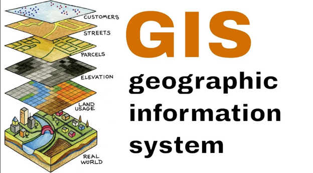
Spatial data infrastructure, satellite remote sensing, and precision geodesy have become essential to modern infrastructure, environmental monitoring, and autonomous navigation. At the forefront of these technological disciplines is Wuhan Daxue Xuebao (Xinxi Kexue Ban) widely recognized in international academic literature as the Journal of Geomatics and Information Science of Wuhan University.
As one of the premier academic journals in Earth observation, spatial informatics, and surveying engineering, this peer-reviewed publication provides a vital link between fundamental geospatial research and practical engineering solutions. Hosted the journal serves as an authoritative platform for scientists, geodesists, and spatial data experts worldwide.
Academic Identity and Institutional Excellence
Wuhan Daxue Xuebao (Xinxi Kexue Ban) (ISSN: 1671-8860) is published under the academic stewardship of Wuhan University, an internationally renowned center of excellence in surveying, mapping, and Earth observation science.
The journal maintains a rigorous editorial standard that reflects Wuhan University's long-standing leadership in geomatics engineering. Indexed by major international database systems—including Ei Compendex, Scopus, and the Chinese Science Citation Database (CSCD)—the publication ensures high visibility, strict citation tracking, and global discoverability for contributing authors.
Core Research Domains and Scope
The scientific scope of Wuhan Daxue Xuebao (Xinxi Kexue Ban) covers the full spectrum of geomatics engineering, spatial data processing, and location-based services:
Precision Geodesy and Navigation Systems
Geodetic science provides the geometric and physical foundation for tracking Earth systems. Key publication areas include:
● Global Navigation Satellite Systems (GNSS): Multi-constellation Precise Point Positioning (PPP), real-time kinematics (RTK), and ionospheric error modeling.
● Physical Geodesy: Gravity field modeling, satellite altimetry, sea surface topography, and crustal deformation monitoring.
● Integrated Inertial Navigation: Fusion algorithms coupling GNSS, INS, LiDAR, and visual odometry for autonomous vehicles and robotics.
Remote Sensing and Photogrammetry
Extracting actionable intelligence from satellite, aerial, and drone imagery requires sophisticated signal processing and optical algorithms:
● InSAR & Radar Processing: Interferometric Synthetic Aperture Radar for monitoring land subsidence, volcanic activity, and structural health.
● Hyperspectral & LiDAR Analysis: Environmental monitoring, forestry biomass estimation, and high-density 3D urban reconstruction.
● Satellite Constellation Calibration: Sensor calibration, radiometry, and atmospheric correction protocols.
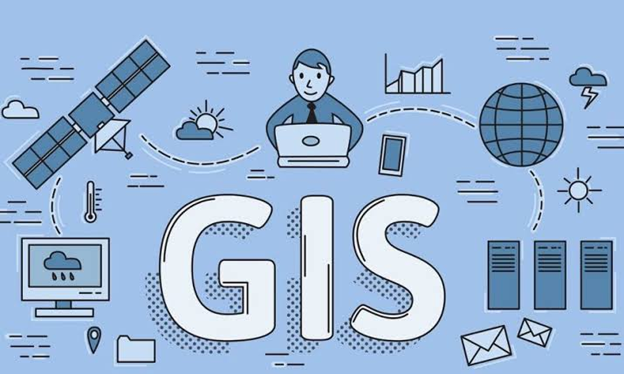
Geographic Information Systems (GIS) and Spatial AI
Modern GIS goes beyond static mapping to incorporate real-time big data analytics and artificial intelligence:
● Spatial Artificial Intelligence (GeoAI): Deep learning architectures for automated feature extraction, land-cover classification, and object detection.
● Digital Twin Systems: 3D Spatial Data Infrastructure (SDI), BIM-GIS integration, and dynamic urban traffic simulation.
● Spatio-Temporal Data Mining: Trajectory processing, location-based social network analytics, and epidemic modeling.
The Rigorous Peer-Review Process
Maintaining scholarly integrity is central to the mission of Wuhan Daxue Xuebao (Xinxi Kexue Ban). Every submitted manuscript undergoes a structured evaluation process to ensure scientific accuracy and technical depth.
<Sequence>
<Step title="Initial Editorial Screening" subtitle="Scope and originality verification">
The editorial desk reviews incoming manuscripts for scope alignment, originality, ethical compliance, and structural formatting.
</Step>
<Step title="Double-Blind Peer Review" subtitle="Independent domain expert evaluation">
At least two independent experts in geodesy, photogrammetry, or spatial informatics conduct a double-blind evaluation assessing methodology, mathematical formulation, and empirical data validation.
</Step>
<Step title="Author Revisions & Verification" subtitle="Addressing technical refinements">
Authors refine their methodologies, calculations, and analytical claims in direct response to reviewer suggestions and technical queries.
</Step>
<Step title="Final Acceptance & Production" subtitle="Typesetting and open access indexing">
Approved manuscripts undergo professional typesetting, reference verification, and bilingual metadata enrichment prior to digital release.
</Step>
</Sequence>
Value Offered to Researchers and Spatial Engineers
Publishing in and reading Wuhan Daxue Xuebao (Xinxi Kexue Ban) provides substantial advantages for academics, research institutes, and technology practitioners:
● For University Academics: Access state-of-the-art algorithms, satellite orbit corrections, and open benchmark data sets validated by leading researchers in the field.
● For Government & Surveying Agencies: Refer to verified methodologies for national spatial framework updates, land administration, and disaster mitigation planning.
● For R&D Industry Specialists: Implement cutting-edge computer vision, sensor fusion, and spatial modeling techniques in commercial software and hardware systems.
Scholarly Structure and Article Categories
To accommodate different stages of scientific discovery and engineering innovation, the journal publishes diverse manuscript types:
Manuscript Type | Structural Focus & Content | Target Audience |
Original Research Papers | Novel mathematical formulations, empirical field evaluations, and algorithmic innovations in geomatics. | University faculty, doctoral candidates, R&D specialists. |
Technical Communications | Rapid reporting of new software tools, satellite payload calibration results, or regional geodetic networks. | Surveying engineers, software developers, field technicians. |
State-of-the-Art Reviews | Critical evaluations of emerging trends such as quantum geodesy, lunar mapping, or GeoAI models. | Research directors, policy planners, postgraduate students. |
Advancing Global Spatial Data Infrastructure
As planetary observation, autonomous transport, and smart cities expand, the research documented in the Geomatics and Information Science of Wuhan University continues to shape global engineering practices.
By featuring studies on carbon sink mapping, ocean surface dynamics, polar ice-sheet tracking, and autonomous vehicle positioning, Wuhan Daxue Xuebao (Xinxi Kexue Ban) demonstrates the critical role of geomatics in solving complex environmental and technological challenges.
Conclusion: Explore the Journal Platform
Wuhan Daxue Xuebao (Xinxi Kexue Ban) remains an indispensable venue for high-level scientific communication in the Earth observation and spatial information sciences. Through its focus on rigorous peer review, cutting-edge geodetic methods, and advanced spatial analytics, the journal continues to advance global knowledge in geomatics.
Researchers, academic faculty, and industry leaders are encouraged to visit the official journal platform to browse current open-access issues, examine author submission guidelines, and submit original research for publication.
Frequently Asked Questions (FAQ)
What is Wuhan Daxue Xuebao (Xinxi Kexue Ban)?
Wuhan Daxue Xuebao (Xinxi Kexue Ban) is the Chinese pinyin title for the Journal of Geomatics and Information Science of Wuhan University, a peer-reviewed journal covering geodesy, remote sensing, GIS, and spatial informatics.
What indexing databases list the journal?
The journal is indexed in major international abstracting and citation databases, including Ei Compendex, Scopus, Chemical Abstracts Service (CAS), and the Chinese Science Citation Database (CSCD).
Does the journal accept manuscripts in English?
Yes. While main text articles are predominantly published in Chinese, articles feature comprehensive English titles, abstracts, key terms, and figure/table captions to ensure global indexing accessibility.
How can authors submit manuscripts?
Authors can review author guidelines, manuscript templates, and copyright policies before submitting papers directly through the official editorial web portal at http://www.wdxxkb-giswu.com/.


Comments